Sand Pit Ballendorf designated as new Geopoint
Sand Pit Ballendorf designated as new Geopoint
The Sand Pit Ballendorf officially becomes part of the UNESCO Global Geopark Swabian Alb Geopoint Network. Since July 3rd 2026, the Sand pit Ballendorf has officially been part of the Geopoint network of the UNESCO Global Geopark Swabian Alb. With its designation as the 41st Geopoint, the Geopark recognizes a geologically significant site that brings to life the era of the ancient Molasse Sea. A new bilingual information panel provides visitors with information about the geological history of the site.
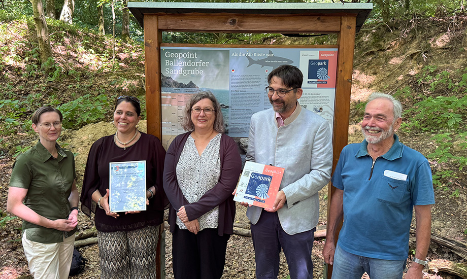
In a ceremonial event, the Sand pit Ballendorf was officially designated as Geopoint. The distinction recognizes not only the geological significance of the site, but also the commitment of the Lonetal Verein e. V. and the many volunteers from Ballendorf who re-exposed the outcrop after it had remained buried for many years. The newly installed bilingual Geopoint information panel explains the special features of the site and invites visitors to discover its geological history on location.
Significance for the Alb-Donau District
During the inauguration ceremony, the speakers emphasized the importance of the cooperation between volunteers, the municipality, the district, and the Geopark. Mayor Verena Stämpfle thanked everyone involved for their commitment. Dr. Diana Kohlmann, First State Official of the Alb-Donau District, highlighted the importance of the new Geopoint for the district. Günther Krämer of the Lonetal Verein recalled the many years of effort that went into re-exposing the site.
The official highlight of the event was the presentation of the Geopoint certificate by Geopark Manager Iris Bohnacker to Mayor Verena Stämpfle. Frederic Blau, geologist at the UNESCO Global Geopark Swabian Alb and responsible for the Geopoints project, designed the information panel and accompanied the preparations for the designation.
Traces of an Ancient Sea
Around 18 million years ago, the Molasse Sea, a shallow sea that once covered the Alpine foreland, flooded large parts of Southern Germany. The Ballendorf Sand Pit documents this period in a particularly vivid way and is the first Geopoint in the Alb-Donau District to represent the Tertiary Period, and thus the era of the Molasse Sea. With the addition of Ballendorf, the Geopoint network of the UNESCO Global Geopark Swabian Alb now comprises 41 sites.
Information: Geopoints identify sites of outstanding landscape, geological, and cultural-historical significance within the UNESCO Global Geopark Swabian Alb.
A more detailed description of the new Geopoint can be found here.