Wental is now Geopoint / Journey into the Earth's History
The Wental valley with its spectacular Felsenmeer (see of rocks) is a popular destination for excursions. The landscape has now been designated a Geopoint by the UNESCO Global Geopark Swabian Alb. This is in recognition of the geological heritage. The Wental is now part of the "Journey into the Earth's History", which includes almost forty geopoints in the Swabian Alb.
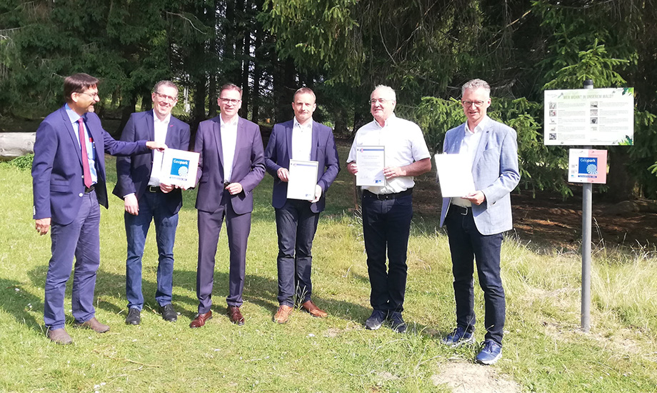
With its side valleys, the Wental extends over six kilometers between the two villages of Bartholomä and Steinheim am Albuch. The district border runs in the northern part in the middle of the valley. The two communities of Essingen and Steinheim share this unique natural heritage. At the ceremonial opening this morning, District Administrator Dr. Joachim Bläse (Ostalbkreis) and District Administrator Peter Polta (Heidenheim District) were on site. Mayor Holger Weise (Steinheim) welcomed the guests. Mayor Wolfang Hofer (Essingen) and Mayor Thomas Kuhn (Bartholomä), as well as Geopark chairman Ulrich Ruckh (Mayor Schelklingen) were also present.
District Administrator Bläse (Deputy Geopark Chairman) spoke in his greeting of a day of joy for the Ostalbkreis and the Geopark. He emphasized that it is not only important to protect and preserve the geological heritage, but also to involve the people of the region: "For this, the Geopark is dependent on the support of the districts and municipalities". District Administrator Polta referred to the very successful Geopark Festival held in Steinheim on June 18 and looked forward to the next Geopark event in the district of Heidenheim: On July 21, the Hillerschule in Steinheim will be inaugurated as a Geopark School.
A hike along the valley in the direction of Steinheim is an experience especially for families: Between gnarled trees, bizarre rock formations can be discovered from the path, in which fairy tale figures and animals can be recognized with a little imagination. With the designation as a Geopoint, the Swabian Alb Geopark draws attention to the preservation of this natural heritage, which lies between the conflicting priorities of recreation and nature conservation. Everyone can contribute to this by not leaving the excellent paths when visiting the Wental.
Unique natural jewel
Over millions of years, a landscape has formed with habitats that today provide retreats for rare plants and animals. The area of almost three hundred hectares has been a nature reserve since 2008. Various geological processes were involved in the formation of the landscape. Over time, thick layers formed from the sediments of the Jurassic Sea, which covered all of southern Germany 200 million years ago. The typical light-colored limestones of the Alb plateau were formed from these rocks. The limestone then weathered, karstified and a river made its way. This is how the Wental valley was formed. The river that formed the valley and exposed the fantastic dolomite rocks has now disappeared. That is why one speaks of a dry valley so typical for the Swabian Alb.
Photo (from left): Ulrich Ruckh, Peter Polta, Joachim Bläse, Hoger Weise, Wolfgang Hofer, Thomas Kuhn